 |
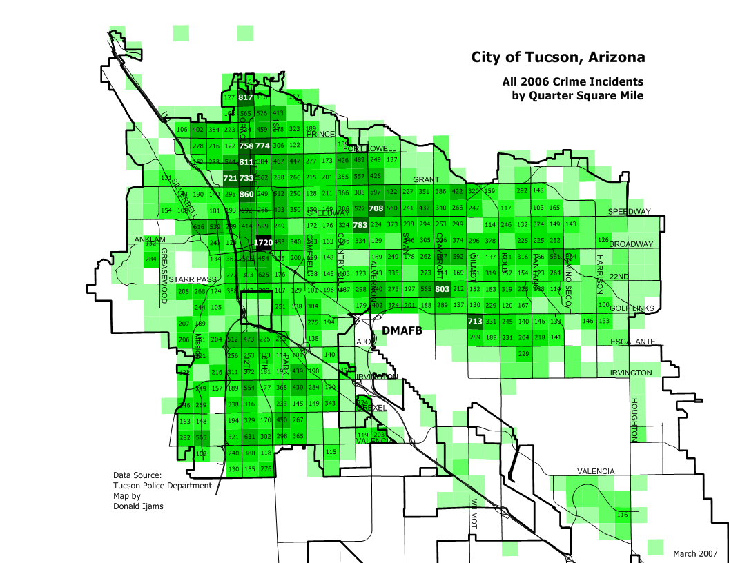
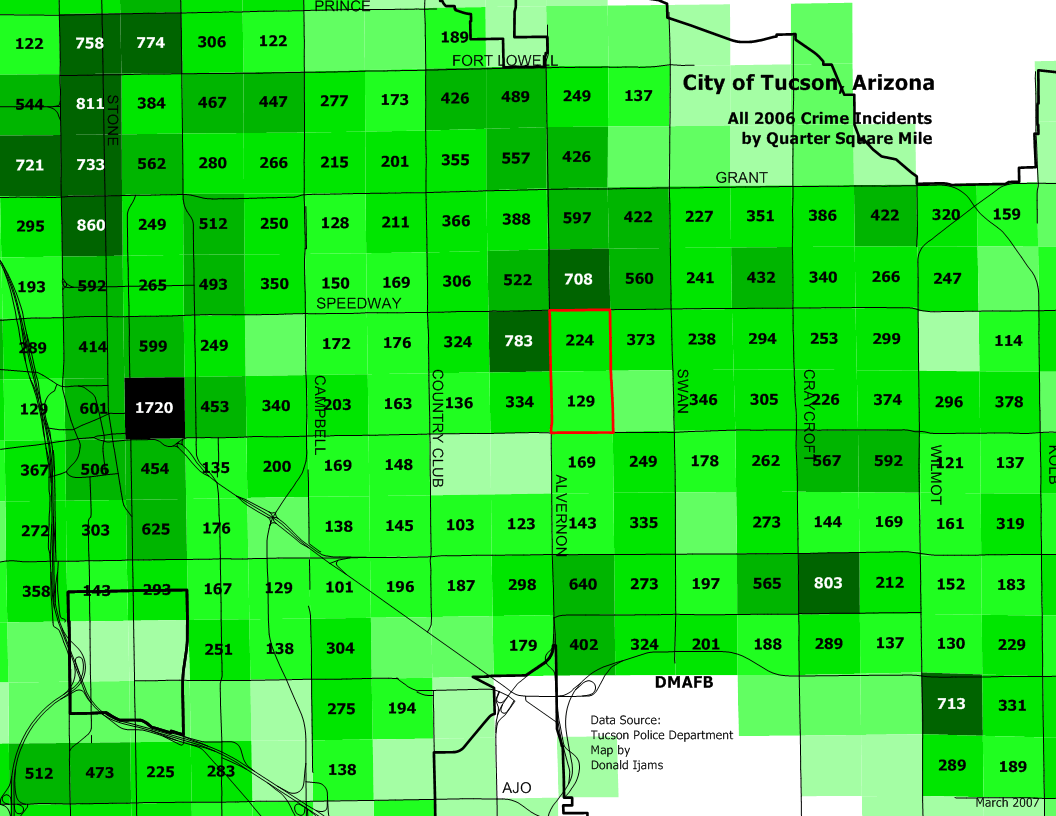
Maps and tables provided here use a public data set available from the Tucson Police Department. This information is unofficial and subject to change. |
Recent Police Incidents in Peter Howell Neighborhood |
| 2009 Police Incident and Crime Data |
| 2008 Police Incident and Crime Data |
| 2007 Crime Maps |
|
| 2006 Crime Maps |
|
| 2005 Crime Maps |
|
|
|
The maps are based on crime incidents reported to or discovered by the Tucson Police Department. Each incident is processed to produce X and Y coordinates, based on the street address for the location of the crime. Occasionally, there are multiple incidents at the same address. This is sometimes due to more than one crime at a single family or convenience store address throughout the year, or due to multiple incidents at an apartment set all with the same address. Incidents reported to U of A, South Tucson or other police agencies are not included. Individual incidents are aggregated into the multicolored surface you see through use of a computer program available to the public called CrimeStat III. One of the portions of the program allows the production of a kernel density surface, which takes into account the location of each incident and the number of incidents at that location. Crime density is relative. The darkest areas on a crime density map show the highest concentrations of crime incidents. If the City had half the crime or twice the crime is now has, the highest concentration areas would still be darkest. "Highest" concentration does not mean "high" crime. These particular maps all use the following parameters for the kernel density calculation: a 2640 ft. search radius, quartic interpolation and a 250 ft. cell size. The Peter Howell Neighborhood area is outlined in red or blue, depending on the map. Maps were created using the Manifold System 6.5 desktop geographic information system. |
Discussion of Crime Prevention Rental Agreement |
Be A Good Witness |
| Home | School | Last Meeting |
| About | Services & Contacts | Neighborhood Crime |